


Côte Dijonnaise app for iPhone and iPad
Developer: Loic Brunot
First release : 27 Jul 2016
App size: 59.11 Mb
With the application "Côte Dijonnaise", quickly visualize all the circuits of discoveries on the territory around Gevrey-Chambertin, the South from Dijon to Nuits-Saint-Georges.
More than 20 proposals of routes to be downloaded, together or separately, grouping the pedestrian, equestrian hiking trails, mountain bike, bicycle touring, sites of climbing, circuit of automobile discovery.
The pedestrian routes behave as tape guides
In every points of stages, the application warns to you by means of a sound signal that an audio contents are available. In addition, points of audio guides start automatically to guide you throughout routes.
For every type of routes, the following information is presented:
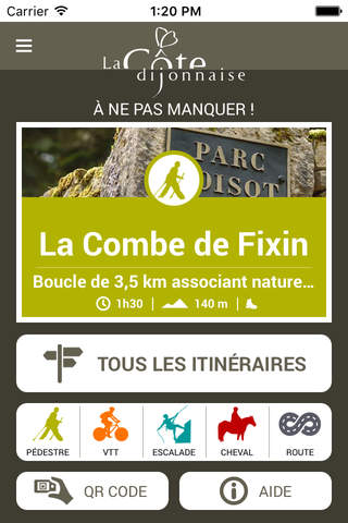
Pedestrian hiking trails
- Marking, time of course, distance and difficulty
- Description of the path and the stages important to discover with audio support
- Plan of the path
- Access to sites with geo-localization
- Display of the stages and the sites with photographic illustrations
Routes of discoveries automobile and bicycle touring
- Time of course, distance
- Description of the path and the stages important to discover
- Plan of the path with geo-localization
- Display of the stages with photographic illustrations
Paths MOUNTAIN BIKE
- Marking, time of course, distance and difficulty
- Description of the path and the stages important to discover
- Plan of the path with geo-localization
- Display of the stages with photographic illustrations
Climbing Sites
- Time of approach
- Lengthes and difficulties of ways
- Description of sites and sectors
- Plan of the accesses to ways with geo-localization
- Display with photographic illustrations
Paths equestrian
- Marking, time of course, distance and difficulty
- Description of the path and the stages important to discover
- Plan of the path with geo-localization
- Display of the stages with photographic illustrations
Continued use of GPS running in the background can dramatically decrease battery life.
An application realized by the Tourist office of Gevrey-Chambertin, in partnership with the natural service of “Communauté de Communes of Gevrey-Chambertin” and the region “Bourgogne Franche-Comté”.
Conception / Creation / Programmation : Studio Indelebil